Huntington – Supervisor Chad A. Lupinacci is excited to
announce the integration of filings from the Suffolk County Clerk’s office with
the Town of Huntington’s Professional Geographic Information System (GIS) to
help local real estate and land use professionals work more efficiently within
the Town of Huntington, with the Town offering a free 60-day trial for new users of the
Professional GIS.
“Our GIS service is a valuable tool that improves
efficiency for real estate and land use professionals across the industry by
streamlining the research process,” said Supervisor Chad A. Lupinacci. “One of
the goals of my administration has been to increase transparency, cut red tape
and make it easier and more efficient to do business within the Town of
Huntington. Now, our integration with the Suffolk County Clerk's office allows
professionals to access both the Town of Huntington's land data and scanned documents
along with Suffolk County deeds, easements, and other land filings all in one
place.”
Dave Genaway, Deputy Director of the Department of
Planning and Environment, who serves as the Town's GIS Manager, stated:
“Our aim is to provide the public with the best
information system possible so we’re really excited about this new integration.
Upon deployment of our upgraded system, we’ve already seen improvements across
many different departments. Land use planners are able to make better decisions
about building placement and the Town Attorney’s office is able to address the
problem of zombie homes in a much more efficient manner, and that’s just the
beginning.”
Since 1998, the Town of Huntington has been a leader in
the advancement of geographic information systems (GIS) for managing Town
assessments, capital projects and community development information. The Town
of Huntington was the first town on Long Island to provide its residents with a
web-based mapping application for researching property and land use
information.
The Huntington GIS provides users with the latest
property information on file with the Town, all found in a digital map format
on the Town website and use of
the Public GIS is free. Through an integrated mass assessment and land
management system, data collected across Town departments is continually
updated on the Huntington GIS.
The Huntington GIS provides users with a comprehensive
picture of land use issues affecting every property within the Town. There are
two versions of the Huntington GIS map: the free Public GIS and the
Professional GIS subscription service.
In 2015, the Town of Huntington continued their tradition
of innovation with the release of the Professional GIS. Through this
subscription-supported service, the Town of Huntington assists local real
estate and land use professionals work more efficiently and productively,
offering timely and accurate property information; improved decision-making
tools; mobile access for working from the field; affordable solutions which are
easy to manage; reduced cost and time spent on research; and access to reports,
news and events.
The Professional GIS service provides a collection of
tools for performing property analysis, comparative sales reports, and
retrieving land use documents related to a particular site. For more detailed
information, users can perform more advanced queries, or utilize custom
reporting functions.
Through the GIS services, professional users query
property history, filed maps and site plans, ownership records and Building
Department records through improved tools and document management capabilities.
Professional users can search through historic zoning decisions for a specific
site and quickly identify zoning requirements. In addition, users can search
comprehensive planning recommendations and projects which are pending review by
Town agencies and boards.
The Town GIS team worked with the Office of the Suffolk
County Clerk to launch an integration in November 2018 making all land deeds
filed since 1987 available to Huntington’s Professional GIS users. Instant
access to deeds can significantly enhance the real estate marketing and closing
process. Specific property details include previous seller and buyer
information, sales prices, metes and bounds descriptions, land easements,
covenants and restrictions, and more. Combined with specific building permits,
filed maps, and zoning information, the addition of County-filed deeds in
Huntington's Professional GIS significantly improves the deployment of land
information to the public.
Both Huntington GIS services are web-based; a mobile app
is available with the Professional GIS service. There is no need to install any
special software. Sign up to use the
free Public GIS map or sign up for a free 60-day trial of the Professional GIS
service.
More information on the Huntington GIS: http://www.huntingtonny.gov/gis
Questions on the Huntington GIS can be directed to: GISPro-Admin@huntingtonny.gov
or (631) 351-3196
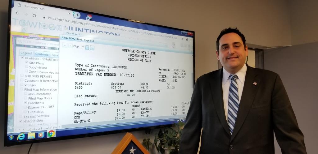
In the photo: Supervisor Chad A. Lupinacci with the
Professional Huntington GIS displaying a Suffolk County-filed deed in the open
window.
###